
Active travel and improvements
Information about active travel and the wide range of improvements made across Worcestershire.
There have been a wide range of improvements made across Worcestershire in 2024 and in 2025.
Improvements include:
- crossing improvements at Windermere Drive, Worcester and Load Street, Bewdley
- footway widening at Newtown Road, Worcester, Main Street, Bretforton, Crumpfields Lane, Redditch, Colts Lane, Redditch and Windsor Road, Redditch
- Public Rights of Way (PROW) improvements in Worcester
- new Zebra crossing at Wylds Lane, Worcester, Austin Road, Bromsgrove, Main Street, Bretforton, Batchley Road, Redditch, Canada Way, Worcester
- new Toucan crossing at Westlands Roundabout, Droitwich and Bath Road, Worcester
- new Puffin crossing at Sutton Road, Kidderminster, Main Road, Kempsey and Woodgreen Drive, Worcester
- new footway at Davies Road, Evesham
- new mini-roundabout Batchley Road, Redditch
- the installation of 31 dropped kerbs
To see these improvements in a visual format please download:
Active Travel England Funding
We were invited to bid for funding from Active Travel England for the implementation of active travel schemes.
A bid was submitted which focused on two schemes; Improving the connectivity across Westlands Roundabout in Droitwich and Diglis Bridge to Power Park in Worcester.
The scheme at Westlands Roundabout includes the installation of two Toucan Crossings over the western arms of the A38, a shared used path from Kidderminster Road to Westwood Road, and an improved uncontrolled crossing facility over Meadow Road, leading to the Westlands Estate.
The scheme linking Diglis to Power Park includes the introduction of a 20mph zone and sinusoidal ramps along Waverley Street and Norton Road, an upgrade to the existing Zebra Crossing to a Toucan Crossing on St. Peter’s Drive, and shared use facilities along Old Norton Road.
Final allocation for the ATF4e bid was £748,899.
Maps detailing the works on both schemes can be found below.
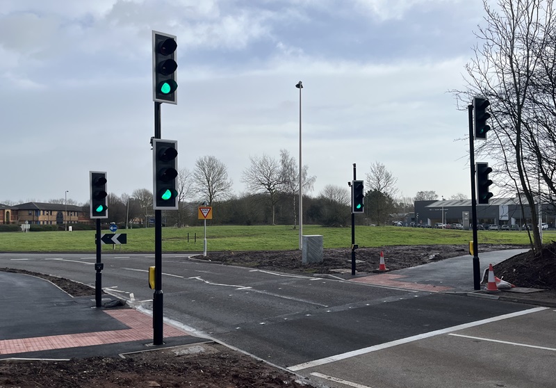
Westlands Roundabout
New crossings now open
The two new Toucan Crossings across the western arms of the A38 and an upgraded uncontrolled crossing over Meadow Road are now open.
The new route linking Kidderminster Road to Westwood Road has also been installed.
There will be some additional widening works, later in the year, along Kidderminster Road to accommodate a shared use path.
A38 Westlands Toucan Crossing Map - 101A (PDF)
Map description: This map shows the positioning of the new Toucan Crossing on the A38 arm of the Westland Roundabout towards Worcester. The crossing will be 4 metres wide, there will be a 3.5 metre shared use cycle/footway to the north and south of the new crossing.
Other works include, narrowing parts of the roundabout to reduce vehicle speeds, new keep clear marking on the roundabout and reducing the size of the traffic splitter island on the Kidderminster Road exit to accommodate the wider cycle/footpaths on either side.
There will also be a proposed new speed limit of 30mph, tree planting in the centre of the roundabout, wildflowers in various locations and new cycling and walking signage. New lighting columns will be installed on Kidderminster Road.
A38 Westlands Toucan Crossing Map - 102A (PDF)
Map description: This map shows the crossing on the Meadow Road approach to Westlands Roundabout being raised across a narrowed junction, to provide a priority footway crossing. There will also be a variety of new humps ahead, shared use cycle/footway and distance signs installed at various points around the new crossing.
There’s also a new Toucan Crossing being installed on A38 Roman Way, which will be 4 metres wide and linking into paths either side. The map also shows the existing carriageway being narrowed to reduce speeds, new trees planted on the approach to the new crossing, new illuminated crossing signs and various other walking and cycling signage.
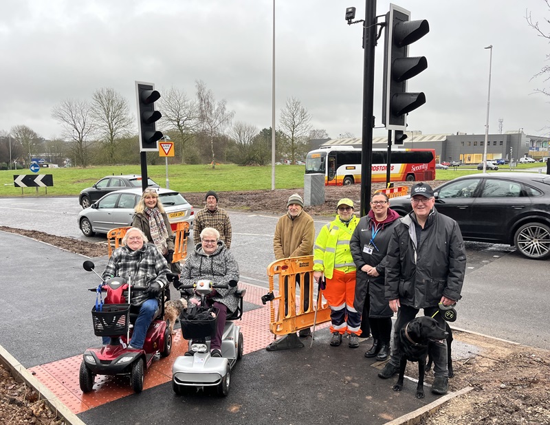
Public meeting
A public meeting was held on 21 November 2024 to provide an update and answer questions relating to the A38 Toucan crossing scheme at Westlands Roundabout.
Download notes from the Westlands Roundabout public meeting (PDF)
Self Assessment
The Council has delivered a number of schemes in the county, compliant with LTN 1/20, including:
- fully segregated cycleways
- secure cycle parking
- junction enhancements for active travel
- route improvements
- new road crossings
- routes in 20mph zones
- three active travel bridges
Further proposals in development, include:
- significant walking and cycling provision integrated into major road network
- Levelling Up Funding applications
- committing internal Council funding to deliver a further two new active travel river bridges to enhance connectivity and facilitate modal shift
We have committed around £20million of project funding to active travel, and 33% of section 106 and section 278 funding from developers.
Related
Plans that identify and prioritise improvements for walking, wheeling and cycling in Worcestershire.
 Facebook
 X
X Email
Email WhatsApp
 Messenger