
BREP Frequently Asked Questions
More information about the BREP schemes.
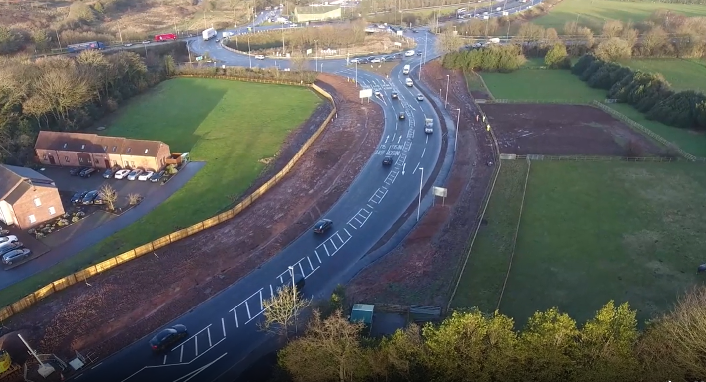
The A38 is one of Worcestershire's most important strategic transport routes, connecting northern Worcestershire with key destinations throughout the region including the wider West Midlands and the Strategic Road Network (the M5 and M42).
It also serves local key destinations (Redditch, Droitwich and Kidderminster) as well as local access throughout Bromsgrove and the town centre. It forms part of the country’s Major Road Network (MRN) which are the links just below motorway and trunk road status. It is the key transport corridor within Bromsgrove and is vitally important in terms of access for economic prosperity and well-being in the area.
Significant congestion within the area not only impacts on journey times and journey time reliability but also creates poor environmental conditions. An additional key issue that is often overlooked is the impact of congestion on economic activity and growth and how this hinders the wider prosperity of the area.
FAQs - General
What is A38 BREP?
The A38 Bromsgrove Route Enhancement Programme (A38 BREP) is a series of improvements to the highway network throughout the A38 corridor in Bromsgrove seeking to tackle existing and future congestion and accessibility issues. It includes:
- junction capacity improvements (additional lanes, local widening etc)
- junction safety improvements (junction signalisation, new or improved pedestrian and cycle crossings etc)
- link capacity enhancements (additional lanes, dedicated right turn lanes etc)
- active travel (cycling and walking) improvements both parallel to and crossing the A38 (new and improved footpaths, new and improved cycle paths and new and improved shared pedestrian and cycle routes)
The aim of the A38 BREP is to reduce congestion within the corridor and to tackle many of the issues that are currently present, and which will inevitably get worse in future years as traffic continues to grow and environmental conditions continue to worsen.
I have not heard of A38 BREP previously, what engagement has been done to date?
The County Council undertook an extensive consultation exercise in early 2020 on the A38 BREP schemes.
All of the engagement exercises are described on the County Council website at: Phase 3 of A38 BREP improvements
The website also contains all of the engagement plans, summary engagement reports and various other information on the project.
Were alternative options/Western Bypass looked at?
The Council have investigated several options both within the corridor and the potential for alternative route options to deal with the existing and future issues within the corridor. None of these options investigated to date either elevate the issues of the link and / or are realistically viable alternative solutions.
One of the main alternative options highlighted is the Bromsgrove western bypass. The County Council has reviewed this option. It has concluded that due to the nature, origin and destination and alternative routes currently used, if constructed, the western bypass would have very little impact on the level of traffic on this section of the A38. Therefore, an improvement scheme within this section would still be required to combat the existing and future predicted issues. Even if the western bypass was constructed, the A38 would remain by far the busiest and the main strategic route for Bromsgrove and the most economically important road within the area.
Additional capacity improvements within the corridor including such options as dualling the section, creating a new signalised junction at School Lane etc. would all require significant land / property acquisition to facilitate. This is considered to be both inappropriate within this area and/or economically unviable.
Why 2 lanes southbound not northbound?
Whilst it would be technically feasible to have two lanes northbound (towards the M42), and it would reduce queue lengths on approach to M42 J1, the main capacity issue at this location is traffic blocking back from the A38 southbound through the M42 J1. A two lane approach northbound does nothing to tackle this and therefore the main capacity issue would not be addressed.
It would be equally as technically feasible to have two lanes northbound (towards the M42) as southbound (away from the M42), within this section. With regard to this option the following is concluded:
- although it creates additional storage capacity on the approach to the M42 and the actual queue length approaching the M42 J1 would be reduced, as there is no additional capacity created at the stop line of the M42 J1 (the main restricting factor in terms of capacity) there would only be limited benefits of the scheme
- the main capacity issue at this location is traffic blocking back from A38 southbound through the M42 J1. This option does nothing to tackle this and therefore the main capacity issue will not be addressed
What would be the scenario if BREP was not delivered?
Without BREP, congestion on the A38 between M5 Junction 4 and the Hanbury Turn will continue to put pressure on the network, leading to:
- longer, less reliable journey times
- economical and environmental impacts
- more traffic using unsuitable local roads
- increasing the risk of traffic queues backing onto the M42
This is not only inconvenient but causes an economic and environmental impact as well as increasing the risk of strategic traffic diverting from the A38 and using unsuitable local routes through residential areas.
Tackling the current issues and preparing to accommodate future demand is a key strategic priority for Worcestershire County Council, which BREP was developed to address.
The principal objective of BREP is to increase vehicular capacity along the A38 through a series of junction and carriageway enhancements, complemented by improvements to walking and cycling routes and the provision of new bus infrastructure.
What about the current and future environmental issues?
Many of the environmental issues are made worse by the idling or stop/starting of cars within the corridor i.e., congestion. This creates poor environmental conditions including pollution issues and greenhouse gases. By allowing the traffic to flow more freely this reduces the overall environmental impacts. A full suite of environmental assessments of the scheme has been undertaken and the output results will be published on the County Council’s website in due course
Why do you need to remove so many trees?
In order to accommodate the improvements, vegetation clearance (including trees) is required in some areas of the scheme. Vegetation removal will be kept to a minimum, however where this is unavoidable we are committed to replacing trees on a 2 for 1 basis across the BREP programme.
Where it is possible to do this in the immediate vicinity of where the trees have been removed we will do so but obviously this is not always possible. The replacement trees will be predominantly native species with one or two other species included where it is felt appropriate. This will include field maple, silver birch, alder, hawthorn, hazel and small leaved lime. The replacement trees will vary in size, predominantly 1m-1.5m in height (with both taller and smaller trees where appropriate) as smaller trees generally establish more quickly and have a much better survival rate.
In addition to new trees, bulb planting will be undertaken along areas of the A38 which will include Wild Daffodils. Ecological enhancements such as bat boxes and bird boxes will also be provided along the scheme.
You can find further information on the A38 BREP Webpage linked below: Why do we need to remove trees to deliver BREP?
What do you do to monitor noise and air quality?
One of the reasons BREP is being implemented, is to reduce the amount of time vehicles spend idling in traffic, especially during peak hours which contributes to poor air quality.
To understand the potential impact on the scheme in relation to air quality, modelling was undertaken to estimate changes in levels of air pollutants associated with road traffic emissions and particulate matter which could occur as a result of BREP at nearby sensitive receptors (e.g. residential properties and schools).
The results of this modelling indicated that such changes would be either ‘small’ or ‘imperceptible’ at all of the sensitive receptors considered. Most importantly, however, the modelling indicated that health-based Air Quality Objectives would be achieved at all of the sensitive receptors considered, with BREP in place.
Is the scheme safe?
Safety is the top priority for Worcestershire County Council. We need to ensure the network will be safer after the scheme is completed, in terms of frequency and severity of incidents.
An independent safety assessment has been undertaken and it shows that the scheme will improve safety when compared with not doing anything within the corridor.
The scheme will continue to go through the standard rigorous safety audit process as the scheme develops, to maximise safety within the corridor and surrounding road network.
Existing vehicular speed is an issue, the scheme will make this worse. What is being done about this?
The current speed limit within this section of road is 40mph. Concerns have been raised by local residents to both existing vehicular speeds within the corridor and whether the changes made to road layout would encourage faster speeds. As part of the scheme proposals and following the safety review, the revised proposal would involve the reduction in speed limit to 30mph throughout this section. It is proposed that the speed limit would be to enforce this with speed cameras either at fixed points or with average speed cameras.
Why are there multiple schemes being delivered at the same time?
We deliver schemes concurrently as our funding is fixed and we have a commitment to deliver by the end of 2026.
Delivering in this way is more efficient as it allows teams to complete specific activities before moving to the next scheme, with further teams then following behind to complete their activities (e.g., Utility surveys take place before excavations).
To deliver schemes in a linear way would take more time, approximately double the current duration, which would extend the level of disruption, and incur increased costs.
Why is traffic management needed?
The Health and Safety at Work, etc. Act 1974 and the Health and Safety at Work (NI) Order 1978 require all clients, employers and employees to establish and maintain safe systems of work. Highway authorities, statutory undertakers and contractors must give due attention to the detailed traffic management arrangements at road works sites and incident locations in order to ensure the safety of the public and of their own employees at these obstructions. The Traffic Signs Manual, Chapter 8, is intended to provide a standard of good practice for the signing and marking of obstructions as well as for the temporary traffic control necessitated by such obstructions of the highway.
Traffic Management (TM) is required for the safety of the public, road users and our workforce. It may remain in place, even if activities are not visible, for several reasons such as:
- the road layout has changed so it is not safe to re-open it without additional works (e.g. changes to road markings)
- it is not feasible to remove TM without a road closure
- if it could be removed it might prolong the programme, having to put it on/off
- safety of workers – need offset to live traffic
It may also be the case that activity is taking place but may not be visible, for example if work is taking place under a bridge or behind trees/vegetation.
Why may it appear that there is not a lot of activity taking place?
It is understandable that the workforce may sometimes appear to be inactive. However, there are sometimes pauses in site activities for reasons such as:
- awaiting materials
- accommodating or waiting for other contractors (e.g., utility companies)
- unexpected ground conditions (e.g., invasive species, statutory undertaker apparatus in alternative locations)
- adverse weather
- plant and machinery break down
- rest breaks
- Road Space booking restrictions (which are planned alongside other works within the area)
Where can I find the latest information for upcoming closures and any diversion routes?
Please visit the Latest News and Updates section of the BREP webpage, accessed via the link below: Latest news and progress on the A38 Bromsgrove improvements
When will BREP be completed?
The A38 Bromsgrove Route Enhancement Programme (BREP) consists of several phases, with each phase containing individual schemes. We are currently delivering Phase 3 of BREP which is due to complete by end of 2026.
Where can I find plans of the schemes?
You can find Scheme Plans on the Worcestershire County Council website via the link below: Phase 3 of A38 BREP improvements
What have you done to alleviate the impact of the Stoke Road closure period?
We appreciate that the disruption caused by the road works can be frustrating and have an impact on the travelling public. Please be assured that we are continually working with our contractors to identify opportunities for efficiencies. To date we have:
- instructed weekend working to minimise the closure period
- provided traffic enforcement to deal with inconsiderate/illegal parking by co-op at the Stoke Rd/New Rd junction
- provided pedestrian shepherds for the first two weeks of the school term to assist school children through the new pedestrian diversion route at Stoke Road/Charford Road
- undertaken a walkthrough of pedestrian diversion with a local business
How do you consider the impact of road works?
We appreciate that the disruption caused by the road works can be frustrating and have an impact on the travelling public. Please be assured that we are continually working with our contractors to identify opportunities for efficiencies.
How will the A38 BREP be funded?
Funding for phase 3 of the A38 BREP project has been secured via the submission and approval of a comprehensive business case to the Department for Transport (DfT). Part of the DfT’s assessment was to consider if BREP offered value for money. The majority of funding is provided by the DfT, with additional funding from S106 contributions made by developers.
FAQs - Regents Park Road
What are the works on Regents Park Road – (Scheme 6) for?
Scheme 6 is one of three active travel proposals within BREP Phase 3. The A38 currently presents a significant barrier to cyclists and pedestrians, both for those attempting to cross it east-west and for those navigating it along the north-south axis.
This scheme is critical to improving connectivity for active travel users, particularly cyclists, from the Oakalls estate. It will link key destinations in two primary directions:
- Northwards towards the town centre via Oakalls Roundabout (Scheme E) and Stratford Road
- Southwards to the train station via Drummond Road, Rigby Lane, and New Road (Scheme 3)
By addressing a longstanding gap in active travel infrastructure, Scheme 6 will enhance route coherence and promote safer, more sustainable travel.
Why do you need to make Regents Park Road one way during the construction period?
When developing Traffic Management (TM) plans for a scheme, our primary objective is to minimise disruption as far as is reasonably practicable, while fully complying with legal obligations. However, we acknowledge that some degree of impact is inevitable and cannot be entirely mitigated.
A one-way traffic arrangement has been implemented to avoid a full road closure, helping to reduce disruption and maintain traffic flow throughout the duration of works. Please be assured, we’re monitoring traffic conditions and any delays closely, and our contractor will continue to look for opportunities to improve the programme and reduce impact wherever possible.
What are the access arrangements at junctions along Regents Park Road during the works?
Regents Park Road will be one-way westbound from Avalon Road to the A38 (Oakalls Roundabout) during this period:
- access to/from Medici Road and Abbey Close: Right turn in and out only
- access to/from Green Park Road: Left turn in and out only
- access to/from Royal Worcester Crescent at junction to Regents Park Road west of Avalon Road : No Changes, although there will be approximately one week where it will be restricted to Left in Left out only
- access to/from Avalon Road: No Changes
Why can’t the works be restricted to weekends and or evenings?
Other approaches, such as night closures or weekend-only working; were assessed but found unsuitable due to the nature of the works. Key considerations included:
- extensive carriageway excavations requiring sustained access
- safety concerns where the road could not be left safe for traffic between shifts
- curing times for concrete and other materials
- noise constraints and the potential impact on nearby residents
- extended programme duration due to repeated TM setup and removal
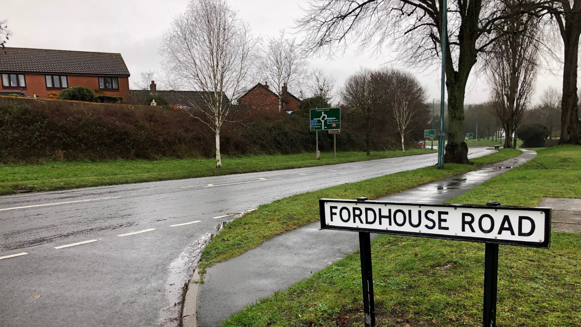
Why is there such a long diversion route?
Diversion routes must comply with the New Roads and Street Works Act 1991 (NRSWA) and adhere to Streetworks guidance. For example, when closing the A38, diverted traffic must be routed via an A road, ensuring a like-for-like alternative that can accommodate all classes of vehicles.
For the current one-way closure on Regents Park Road (not an A road), a height restriction on Alcester Road prevents some vehicles from using it as a diversion. Therefore, the A448 Bromsgrove Highway has been designated as the official diversion route. However, drivers may choose alternative local routes, with some potentially finding B4184 Finstall Road and Alcester Road offer a quicker journey, depending on vehicle type and destination.
Will I still be able to access my property?
Yes – access to properties will be maintained at all times.
Will pedestrian access be maintained?
Pedestrian access will be maintained throughout the works via existing provisions along Regents Park Road, with adjustments in place to ensure continued safe passage:
- Phase 1: The northern footway will be closed. Pedestrians travelling westbound will be directed to cross over to the southern footway to continue their journey safely
- Phase 2: The arrangement will switch; the southern footway will close, and pedestrians will instead use the northern footway for their travel along Regents Park Road
The existing pedestrian crossings at Oakalls Roundabout, Regents Park Road and across the A38 to Stratford Road will all remain fully operational throughout. With the eastbound exit closed onto Regents Park Road, there will be reduced vehicle movements, making north-south pedestrian crossing easier and safer.
To further support safe navigation, pedestrian marshals will be in place at the commencement of the works and at the start of the new school year in September. They’ll help guide pedestrians, especially schoolchildren, as they adjust to the temporary arrangements.
Will access for Emergency Access be maintained at all times during the works?
In advance of the works commencing, the contractor visited the local emergency service stations to provide a reminder of the upcoming closure and to discuss any operational concerns. These proactive visits aim to ensure clear communication and support emergency response planning.
Where feasible, the contractor will assist emergency services in gaining access through the closure. However, this may not always be possible. For example, there may be open excavations within the carriageway that cannot be made safe quickly or securely, either through the use of road plates or rapid reinstatement, posing safety risks.
However, we are confident that based on available data, most emergency vehicles; including fire engines, which typically range from 10 to 12.5 feet in height, should be able to pass safely beneath the low bridge on Alcester Road.
Where can I find Diversion Route Plans?
You can find the diversion plans, once published, within the A38 Bromsgrove Route Enhancement Programme (BREP)
Where can I find the Scheme Maps?
You can find the Regents Park Road – Scheme 6 map, as well as other scheme maps, via the “Phase 3 of A38 BREP improvements” section of the A38 Bromsgrove Route Enhancement Programme (BREP)
You may also find it useful to view the Scheme Map for Scheme E, which includes improvements to the A38 Oakalls roundabout.
See: A38 Bromsgrove Route Enhancement Programme (BREP)
Will I be compensated for the additional travel due to the diversion route?
Unfortunately, there is no statutory compensation procedure for inconvenience or loss of business resulting from lawful road works carried out by the Highway Authority, particularly where access is maintained via diversion routes. This position reflects long-standing government policy, which recognises that temporary disruption to traffic flow is an inherent risk of operating a business adjacent to the public highway.
Contact us
For questions or queries related to Bromsgrove Route Enhancement Programme (BREP), please contact us at:
Related
The A38 is one of Worcestershire's most important strategic transport routes.
Rationale for removal of trees required to deliver A38 BREP.
 Facebook
 X
X Email
Email WhatsApp
 Messenger